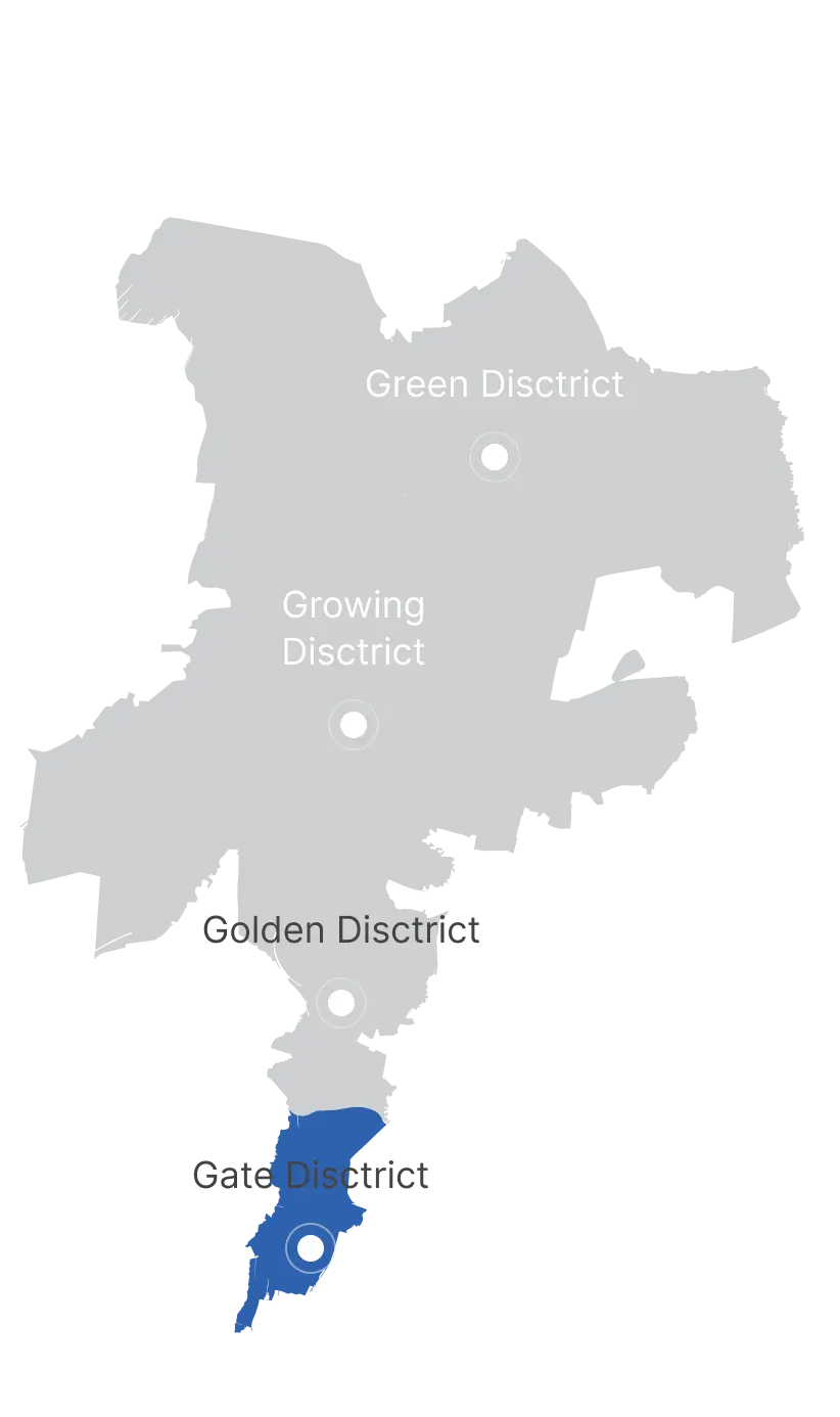
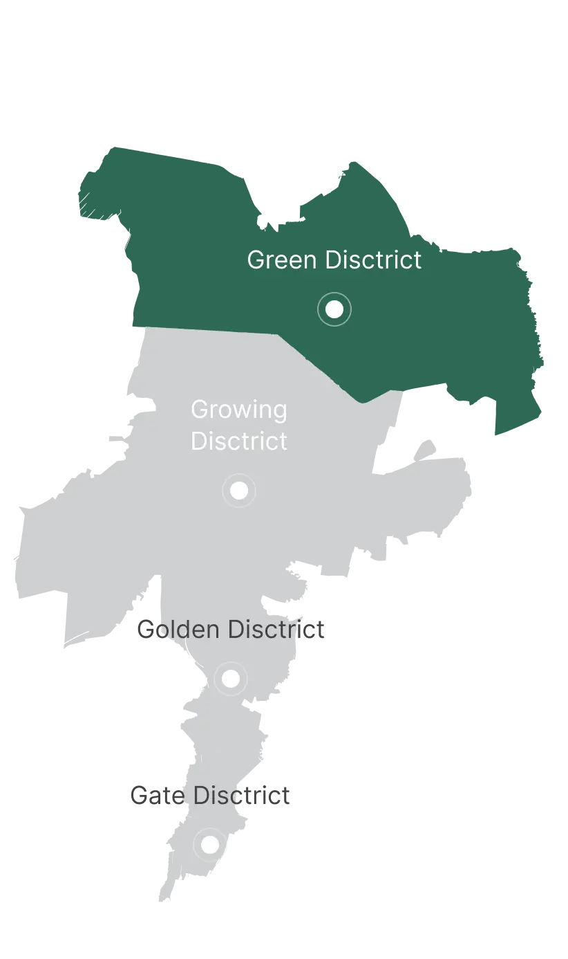
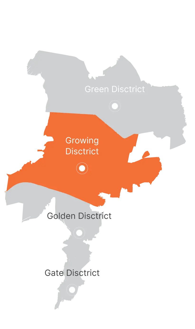
City districts
Alatau is more than just a new city — it is a neighbor to Almaty, one of the largest and wealthiest cities across Central Asia, the Caucasus, and eastern Russia.
As of 2025, Almaty’s population stands at 2.3 million, and combined with the Almaty region, the total exceeds 3.8 million residents. The region’s combined Gross Regional Product (GRP) reaches $73 billion, with Almaty's per capita GRP at $26,400 — comparable to Eastern European countries. Today, Almaty serves as the region’s primary hub for business services, trade, IT, creative industries, and higher education. It is also a key tourism gateway, attracting over half of all international visitors to Kazakhstan.
Located within this rapidly growing agglomeration, Alatau will further amplify the region’s potential, becoming a new center of growth along the "New Silk Road."
The city's development is anchored in four modern thematic districts, each designed to become a center for innovation and advancement in its respective field.

Geography:
The Green District is located south of Konaev city, with its eastern border largely defined by Lake Kapchagay and the Kaskelen River. The north adjoins Konaev, the west borders a railway line, and the south remains an open development area.
The district will be served by the "Almaty – Konaev" highway, a new eastern expressway, and a central controlled-access road. It will also have railway connectivity via the "Almaty – Ust-Kamenogorsk" line, with plans for a future high-speed rail and LRT lines.
District Overview:
Urban planning in the Green District centers around Lake Kapchagay, where a landmark multifunctional complex of over 30 stories will rise — becoming a symbolic highlight of the district.
A central pedestrian avenue will extend diagonally from the waterfront, lined with cultural, commercial, sports, entertainment, and hotel facilities. The lakeshore will feature resorts, amusement parks, diving centers, and golf clubs.
There is also significant potential for developing gaming and entertainment industries, targeting tourists from within a five-hour flight radius. Plans also include building a Formula 1 racetrack.
South of the central boulevard, terraced residential quarters (2–12 floors) will offer scenic views of the lake, while the eastern waterfront will be home to low-rise residences. The landscape will be enhanced with water canals connected to local quarries, creating picturesque recreational routes.
Urban beaches are planned for the northern waterfront.

Geography:
The Growing District is located along a strategic junction of the "Almaty – Kapchagay" highway and the planned expansion of the "Zhetygen – Kazybek Bi" railway line, near the airport. It will connect Alatau with the SEZ "Khorgos," enabling efficient transport links across Central Asia and Europe.
The Kaskelen and Malaya Almatinka rivers flow through the district and will be incorporated into urban park designs.
District Overview:
The Growing District will accommodate modern enterprises that meet ecological standards and do not harm the environment. The district is set to become a key export-oriented logistics hub, driving economic growth and creating new jobs for the Almaty agglomeration.
A vocational and technical education institute will also be established to support professional skills development in the production sector.
Residential areas will be situated along the rivers, with 2–12 story apartment blocks and easily accessible social infrastructure. Walkable neighborhoods will feature polycenters offering cultural, commercial, and sports facilities.

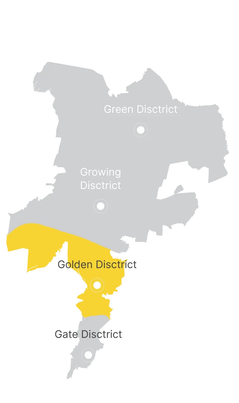
Geography:
Golden District stretches along the primary "Almaty – Konaev" highway.
The Malaya Almatinka River crosses it from east to south, while the Kaskelen River borders it to the west.
A linear park will connect the green zones throughout the district, with mid-rise residential buildings (4–5 stories) planned for the area, rising to 9–12 stories closer to the city’s main axis.
District Overview:
The Golden District will feature a polycentric urban layout. The southern part will host the International Center for Education, Healthcare, and Sports, linked by pedestrian and cycling paths, squares, parks, and observation decks.
The Academic Town will accommodate up to 40,000 students from Kazakhstan and neighboring countries. East of the campus, a Museum of Archaeological History will offer public and recreational spaces.
A multidisciplinary Medical Cluster will deliver accessible, high-quality healthcare services, founded on international collaboration and best practices.
Additionally, an Agri-Industrial and Logistics Hub will provide comprehensive logistics services.

Geography:
The southern boundary of the Gate District directly adjoins Almaty.
Major highways including BAKAD, "Almaty – Konaev," and the "Khorgos" routes pass through the area.
The natural landscape features the Karasu-Turksid and Yntymak canals, and the Essentai River.
District Overview:
According to Alatau’s Master Plan, a key driver of economic growth will be the International Business Development Center, located at the heart of the Gate District.
Almaty, as Central Asia’s financial core, generates strong demand for new, modern business spaces.
The International Business Development Center will offer a diverse range of office solutions, including business hotels and retail venues.
Its strategic position near BAKAD and a future LRT station will make the Center the preferred location for financial institutions within Alatau, further reinforcing its economic significance for the region.